")
")


The laboratory is equipped with advanced research infrastructures, among which a system for the direct acquisition and the on line storage (with a storage capacity over 120TeraBytes) of satellite data in polar and geostationary orbit for the observation of the Earth (e.g. NOAA, EOS, METOP, NPP, MSG), a payload of hyperspectral optical sensors (operating in the VNIR-LWIR spectral range) for aerial platforms, and a suite of ground-based instruments (e.g. FieldSpec, F-TIR spectrometer, MIR/TIR Thermocameras) for remote sensing data calibration/validation campaigns. In addition, the Laboratory is provided with software packages for remote sensing data processing and display (ENVI-IDL, PCI-GEOMATICS, AAPP, McIDAS). In this laboratory different research groups from the Institute work and cooperate in order to develop original techniques of innovative methodologies for remote sensing data analysis, and the experimentation, also in cooperation with the end-users, of products with an added value for environmental and territory monitoring as well as security.
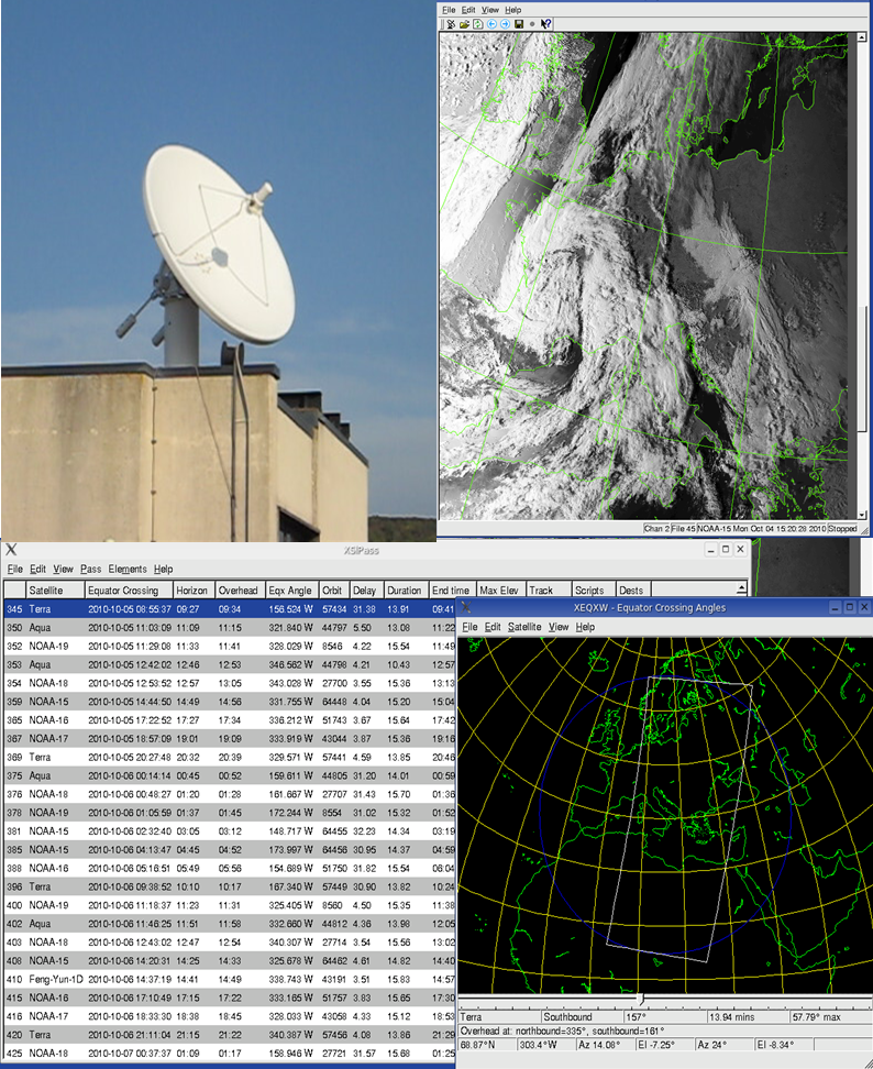
Fig. 1: Direct readout X&L band system for polar orbiting satellite (e.g. NOAA, EOS, METOP) data reception
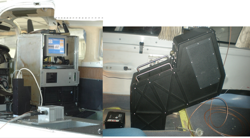
Fig. 2: Airborne payload: left side, Hyspex1600 operating in the VNIR spectral region (0.4-1 µm) with 160 spectral channels; right side, TASI 600 measuring in 32 spectral bands the Earth emitted radiance in the thermal infrared region (8÷11.5 µm).